
Professional Drone Services for High-Stakes Projects
When accuracy, compliance, and reliability matter, we deliver enterprise-grade drone services designed for complex environments and critical projects.
Services
-
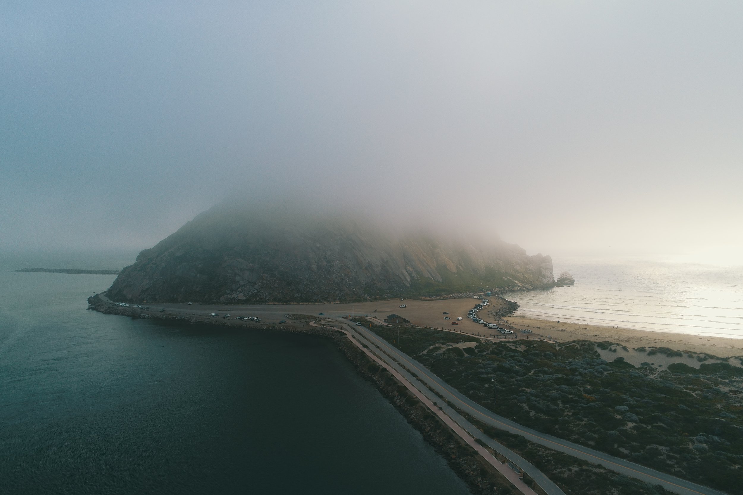
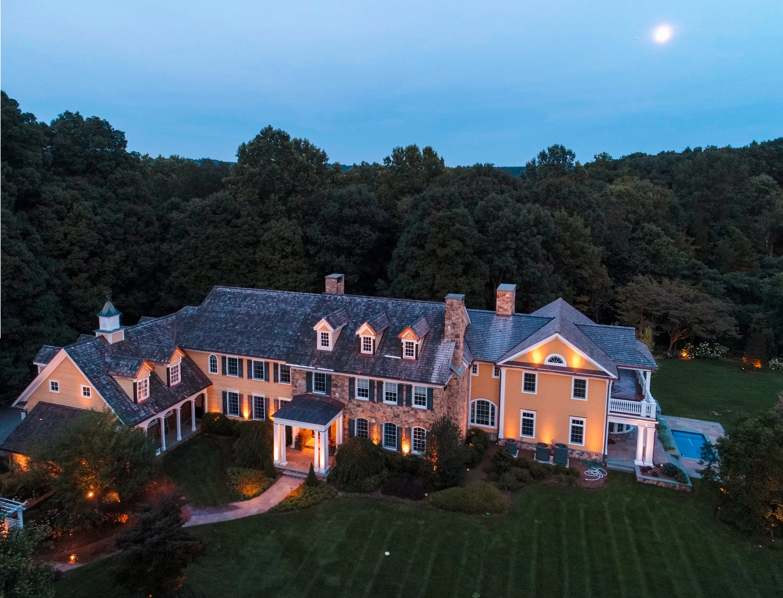
Aerial Photography & Videography
Our aerial photography and cinematic drone videography services deliver high-resolution imagery, 4K–8K video, and dynamic aerial perspectives tailored for real estate, commercial marketing, tourism, and branded content across New Jersey, Pennsylvania, and the NYC metro area. Using industry-leading drones, advanced camera systems, and expert post-production, we create visually striking content optimized for digital marketing, social media, and broadcast. Every flight is executed by FAA Part 107 licensed pilots, fully insured, and planned with precision to capture compelling visuals that elevate brands and tell powerful stories from above.
-
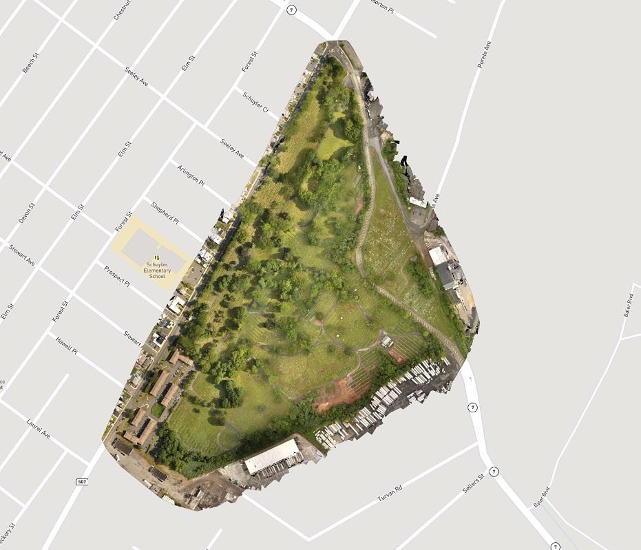
Surveying & Mapping
We provide professional drone surveying and mapping services using advanced photogrammetry, RTK/PPK positioning, and high-accuracy data capture for land surveying, topographic mapping, and GIS applications. Serving engineering firms, developers, and municipalities throughout NJ, PA, and New York, our aerial mapping solutions deliver precise orthomosaics, 3D models, point clouds, and volumetric measurements. Our workflow is designed for speed, accuracy, and compliance, reducing project timelines while maintaining survey-grade results you can rely on.
-
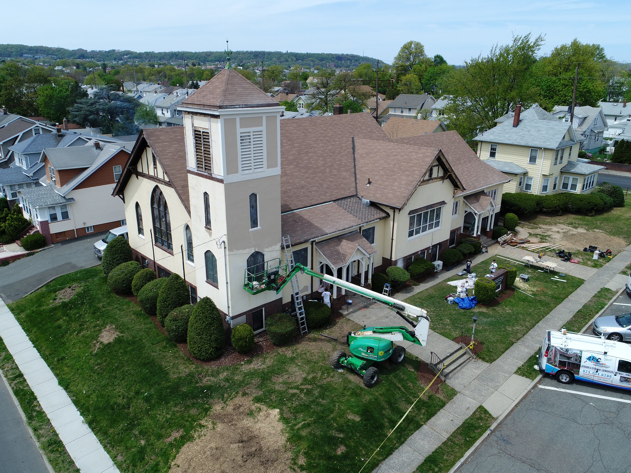
Construction Progress Monitoring
Our drone construction monitoring services offer consistent, reliable aerial progress tracking for commercial and infrastructure projects across the Northeast. We help project managers, developers, and stakeholders visualize progress, document milestones, and improve site safety through scheduled drone flights, time-lapse imagery, and detailed aerial reporting. With a strong focus on risk mitigation and operational efficiency, our FAA-certified pilots provide actionable insights that keep construction projects on schedule and fully documented.
-
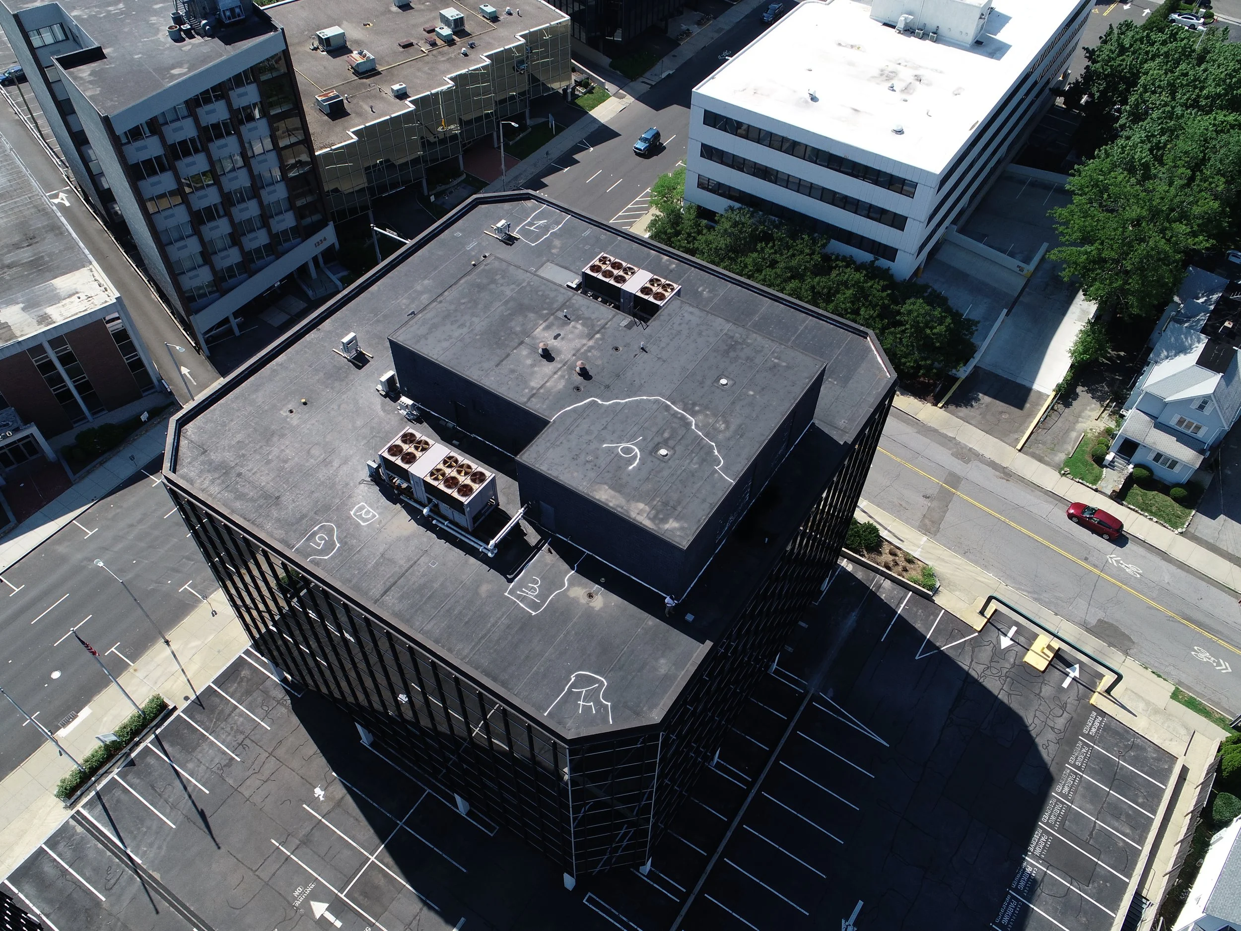
Inspections (Visual + Thermal)
We specialize in professional drone inspection services for roofs, towers, bridges, industrial facilities, and critical infrastructure—delivering safer, faster, and more cost-effective alternatives to traditional inspection methods. Operating throughout New Jersey, Pennsylvania, and the NYC area, our inspections use high-resolution zoom cameras, thermal imaging, and detailed aerial data to identify issues without putting personnel at risk. Safety, accuracy, and compliance are at the core of every inspection we perform.
-
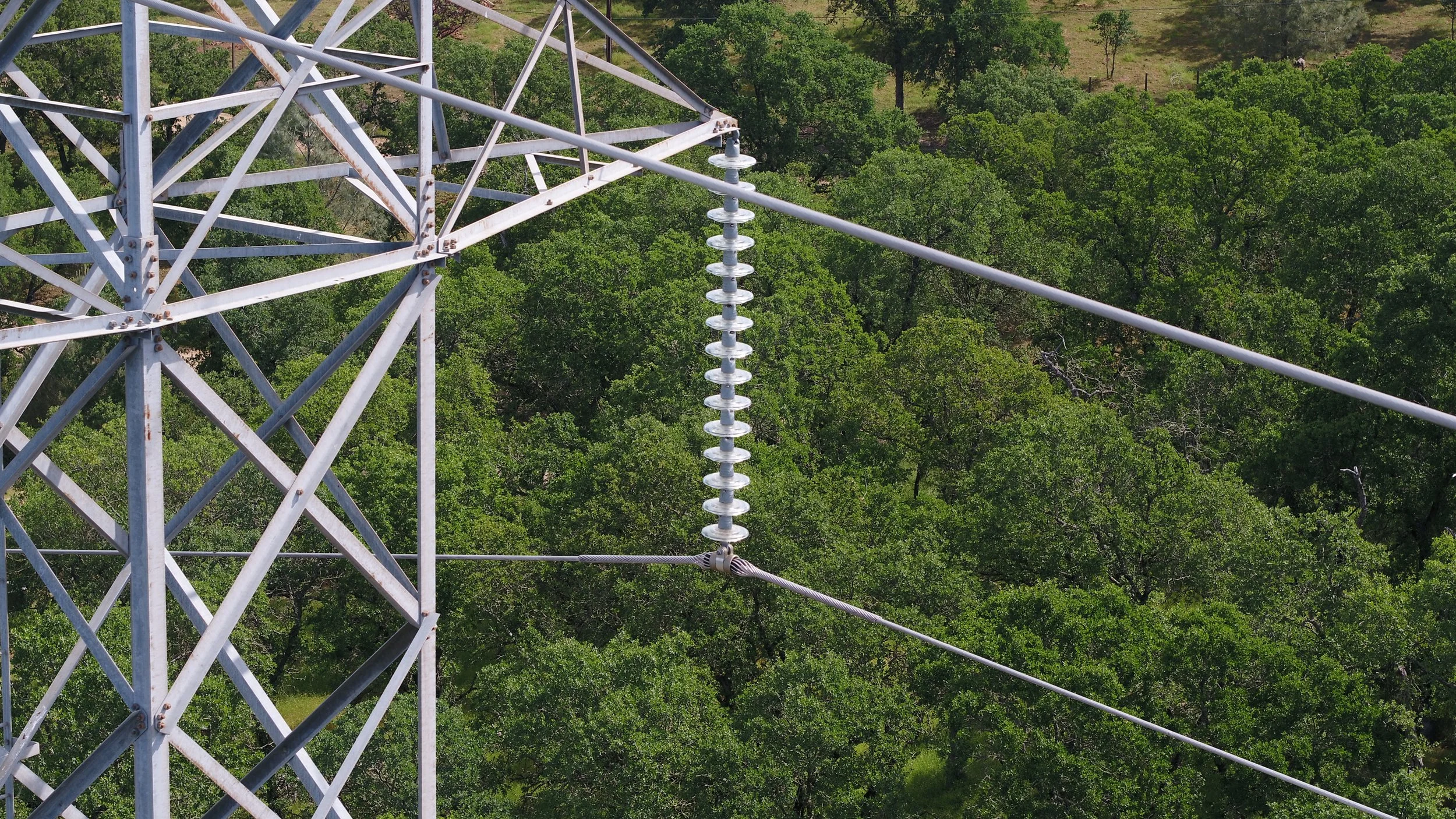
Energy & Utilities
Our energy and utilities drone services support power companies, renewable energy providers, and utility contractors with advanced aerial inspections and data collection. From transmission lines and substations to solar and wind assets, we deliver thermal scans, visual inspections, and high-precision mapping designed to detect faults, reduce downtime, and enhance preventative maintenance programs. Our work has supported wildfire prevention efforts and grid reliability initiatives, all executed by fully insured, FAA Part 107 licensed pilots using enterprise-grade equipment.
-
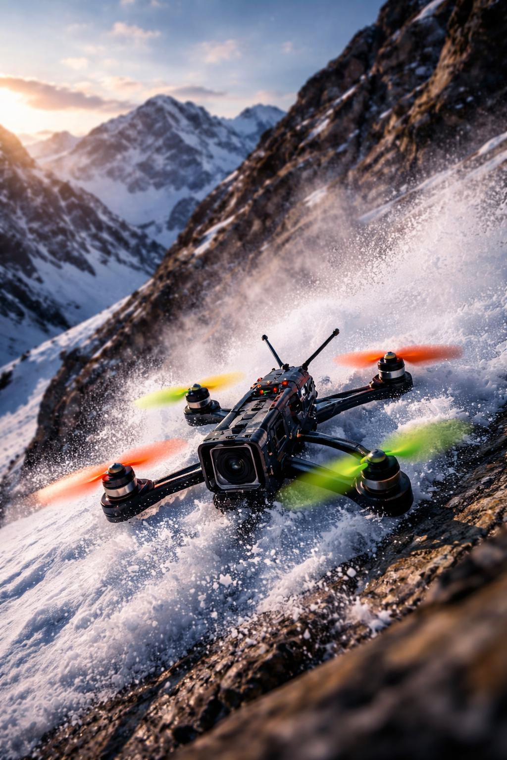
FPV Drone Services
Our FPV drone services bring immersive, high-impact visuals through agile, cinematic flight paths that traditional drones simply can’t achieve. Perfect for commercial advertising, real estate walkthroughs, events, and branded storytelling, our FPV pilots deliver smooth, dynamic footage optimized for social media, web, and broadcast platforms. With a focus on safety, creative precision, and technical mastery, we provide next-level FPV drone videography across NYC, New Jersey, and Pennsylvania.