
Elite Drone Services for Projects That Can’t Fail
Precision aerial imaging, inspections, and data capture across NYC, New Jersey, and Pennsylvania.
What We DoAerial Solutions for Missions Where Precision Is Mandatory
We deliver enterprise-grade drone services built for environments where accuracy, safety, and accountability are non-negotiable. From complex urban airspace to critical infrastructure, our work combines cinematic quality with operational discipline.
Every mission is engineered. Every flight is compliant. Every result is deliberate.

Heights Aerial Media delivers enterprise-grade drone services for developers, engineers, utilities, and commercial teams who demand uncompromising quality.
We fly to provide the highest standard outcomes.

Services Overview
-
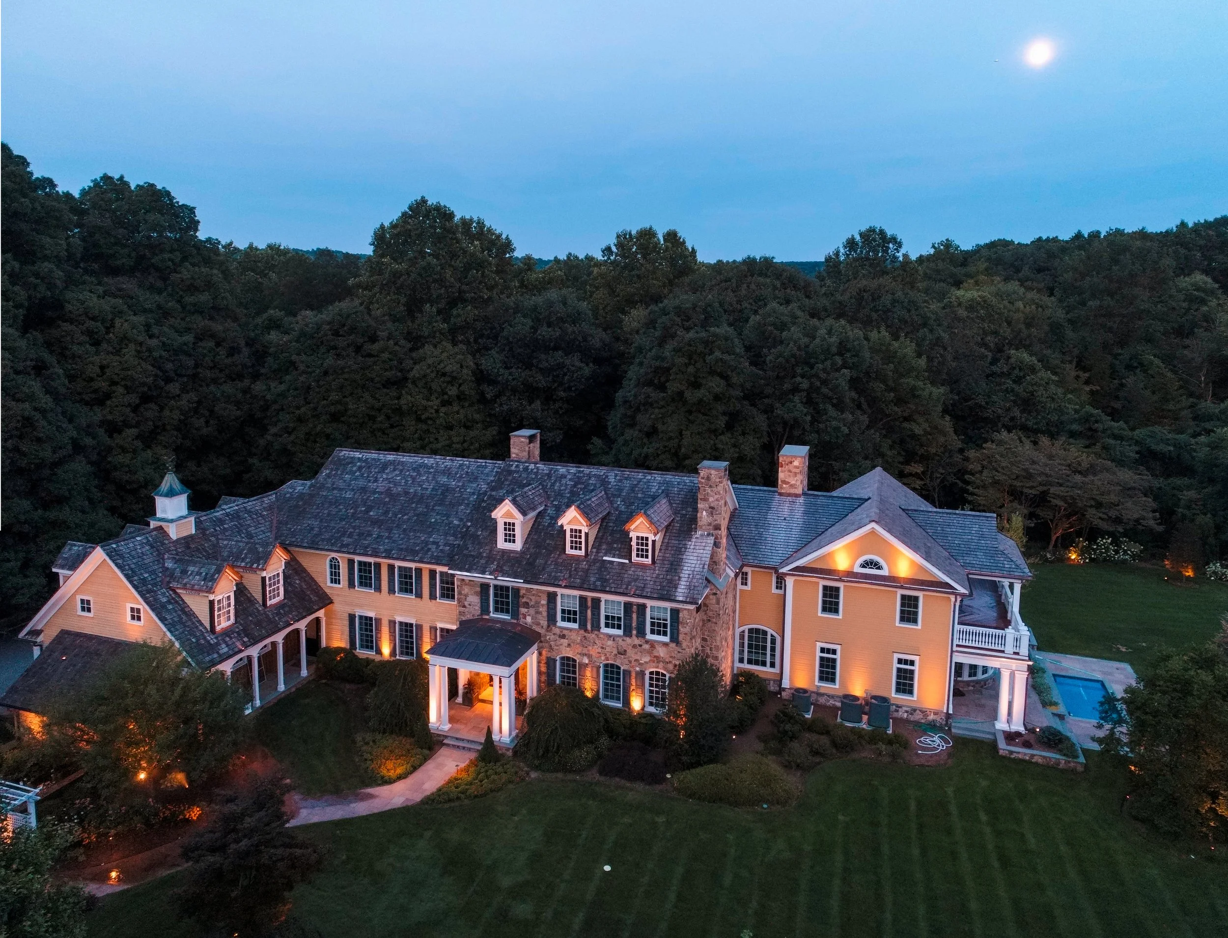
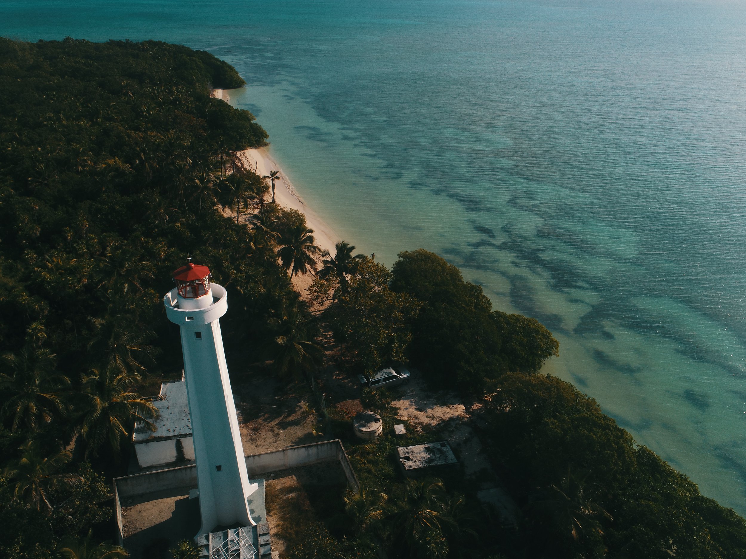
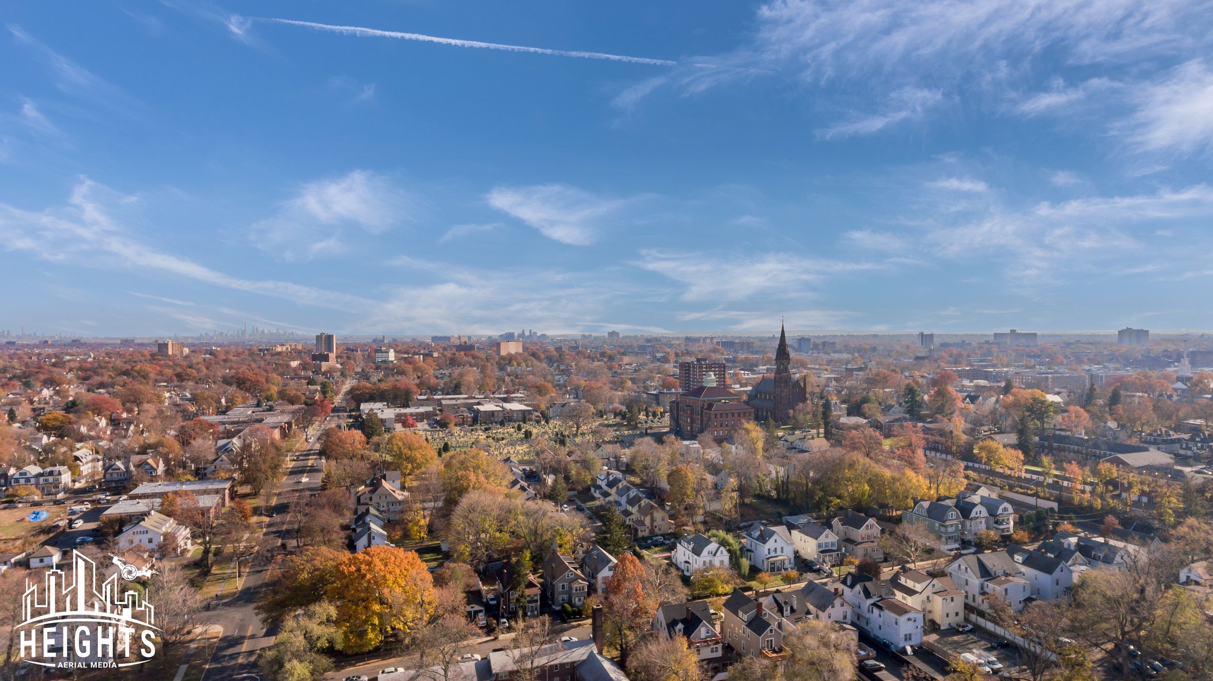
Real Estate Photography
Heights Aerial Media leverages real estate drone photography, aerial videography, cinematic property tours, and high-resolution UAV mapping using top-tier drones to deliver premium, MLS-ready visual content that elevates listings and showcases full property context.
Result: With cutting-edge aerial media, properties gain more engagement, stand out in competitive markets, and can sell up to 68% faster with higher perceived value when using professional drone photography. -

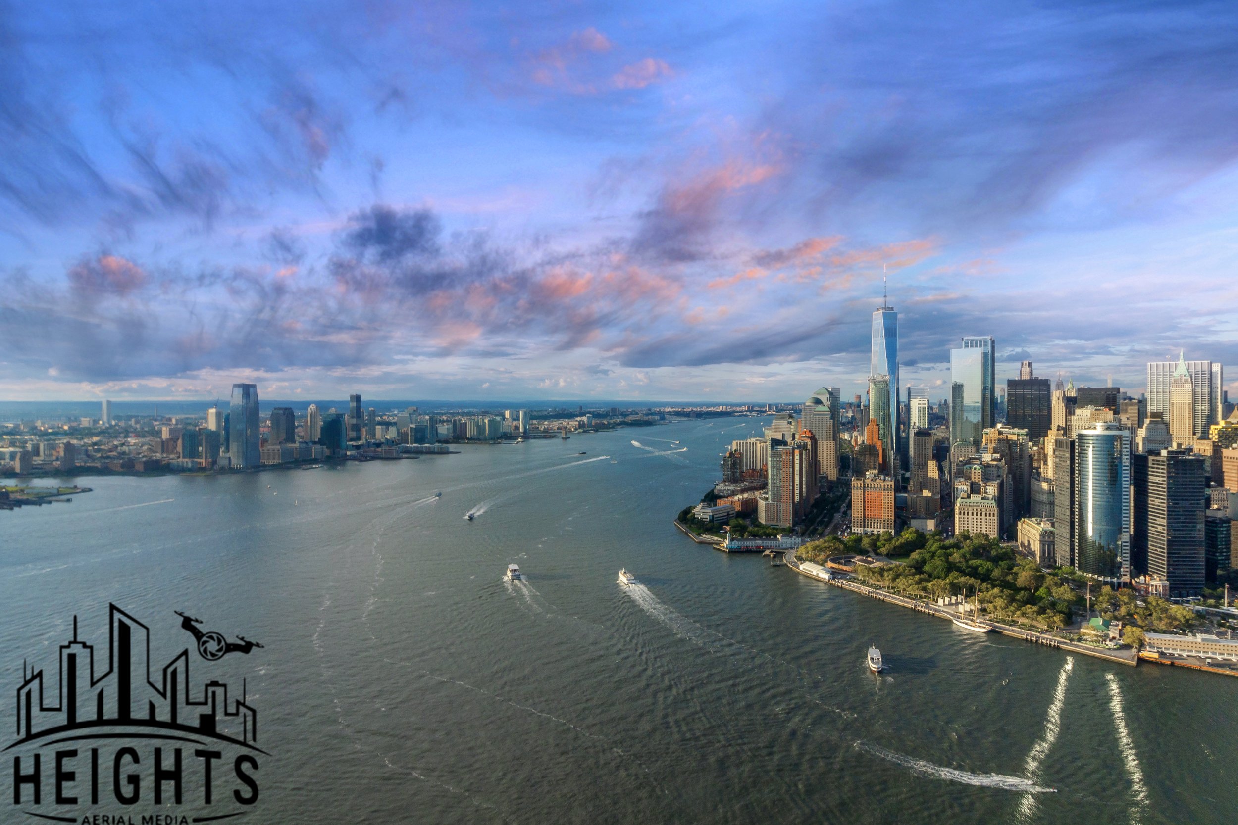
Aerial Photography & Videography
High-resolution photography and cinematic 4K video that elevates real estate, commercial marketing, tourism, and branded storytelling.
Result: Visuals that capture attention and convert.
-
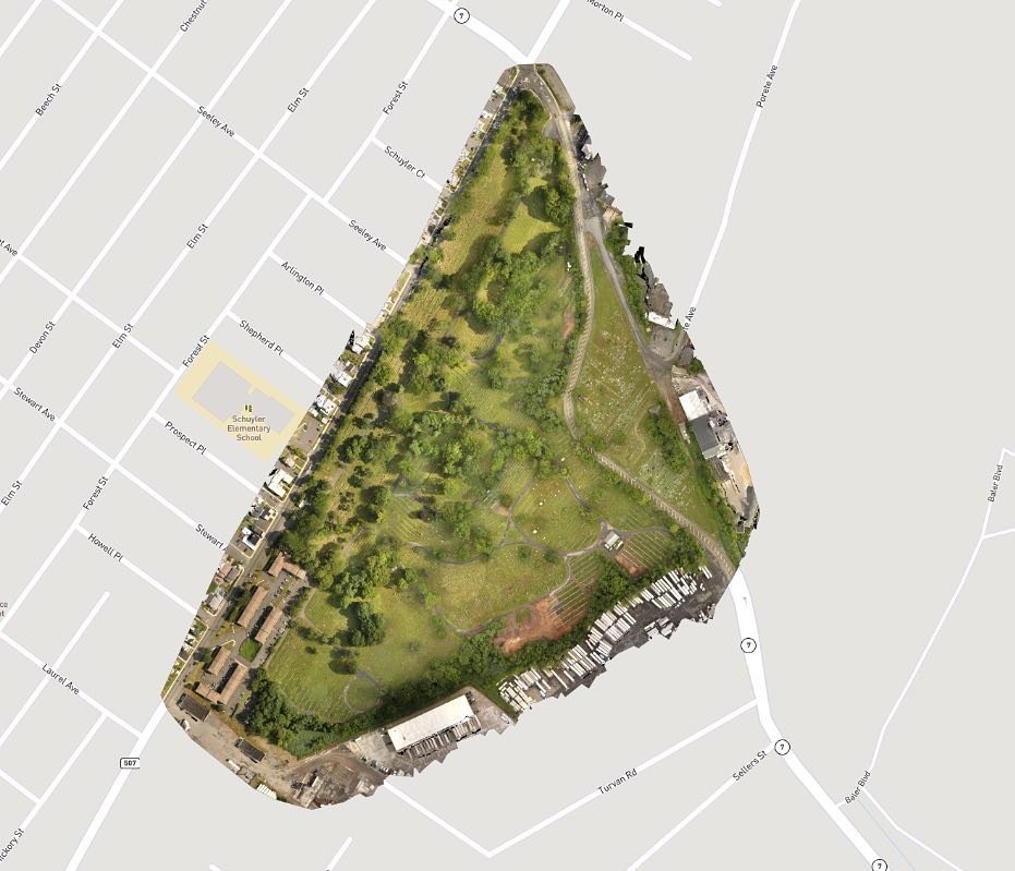
Surveying & Mapping
Precision photogrammetry, orthomosaics, 3D models, and volumetric measurements for engineering, development, and GIS applications.
Result: Data you can trust for critical decisions.
-
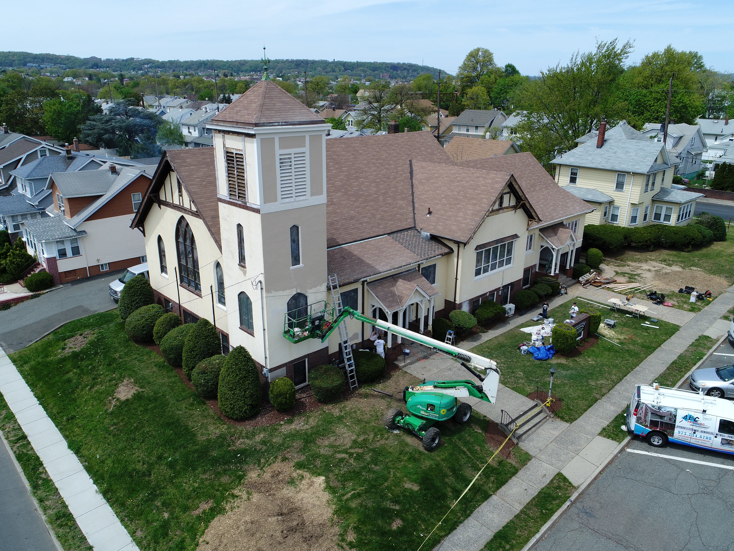
Construction Progress Monitoring
Scheduled aerial documentation that keeps stakeholders aligned and projects accountable from ground break to completion.
Result: Visibility, documentation, and risk reduction.
-
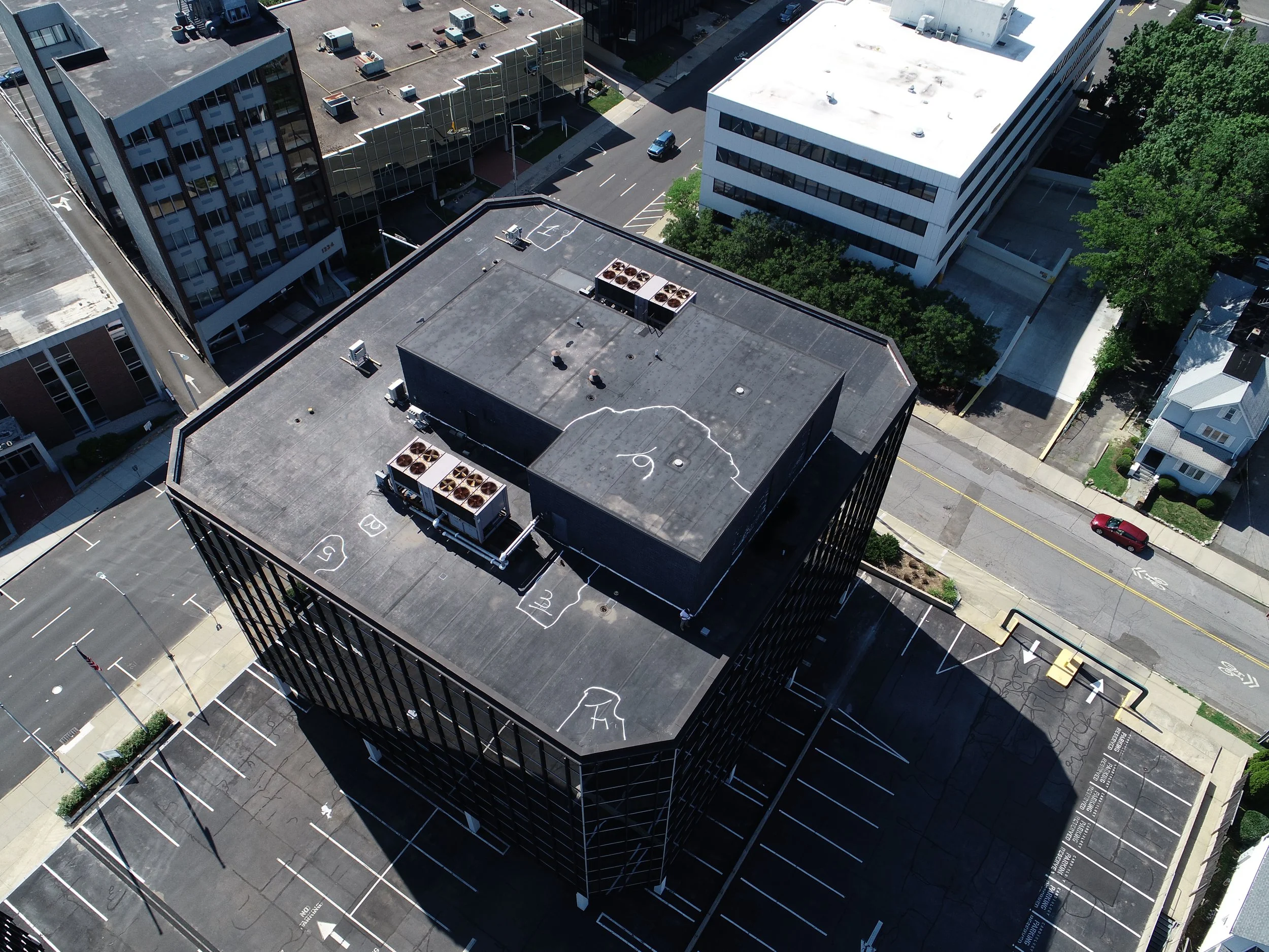
Inspections (Visual + Thermal)
Roof, tower, bridge, and infrastructure inspections using zoom optics and thermal imaging, without putting personnel in harm’s way.
Result: Faster insights. Safer outcomes.
-
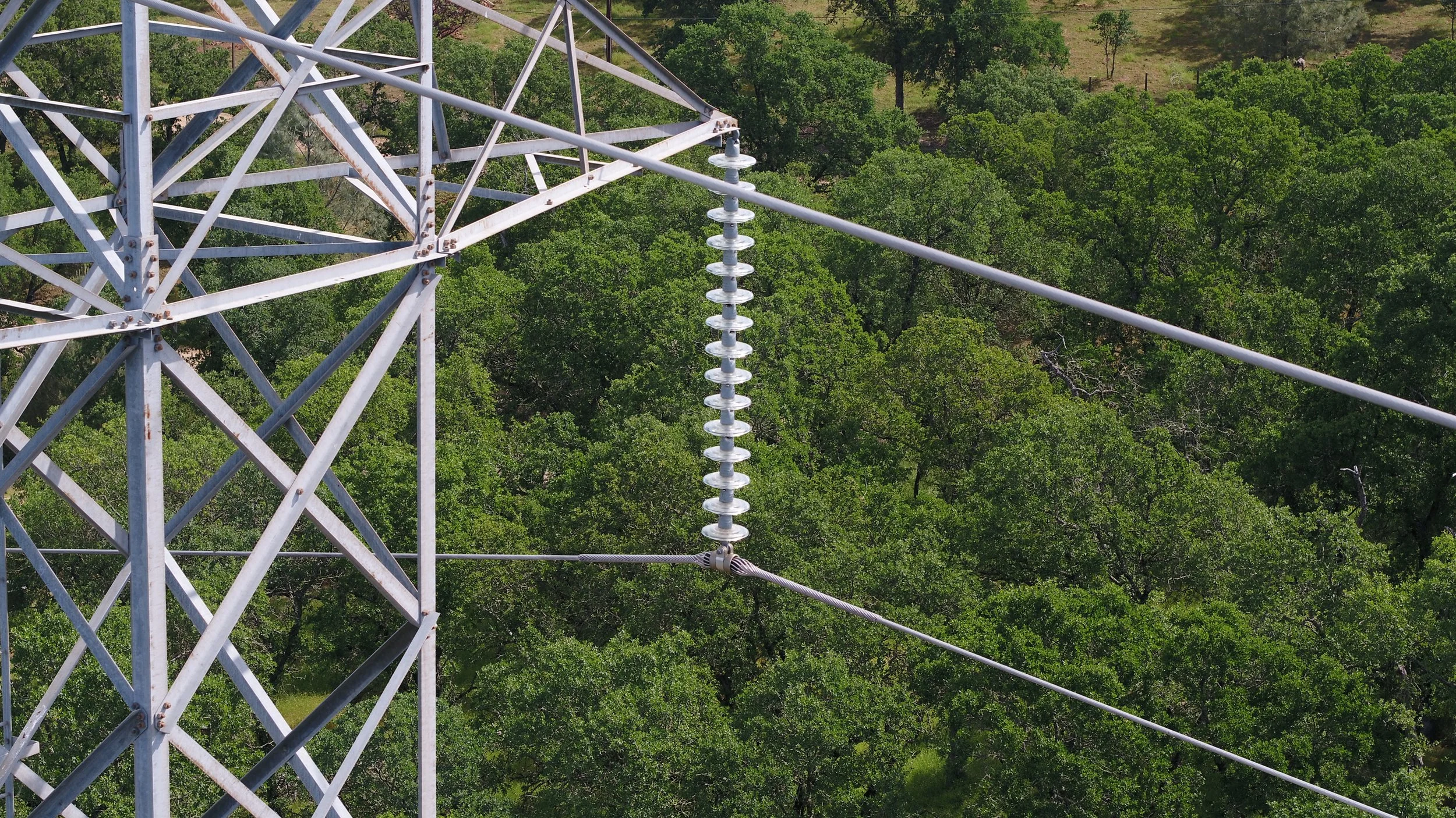
Energy & Utilities
Advanced drone inspections for transmission lines, substations, solar, and wind assets, supporting grid reliability and preventative maintenance.
Result: Early detection. Reduced downtime.
-

FPV Drones
Dynamic, immersive FPV footage designed for marketing, walkthroughs, and high-impact storytelling.
Result: Motion that commands attention.
FAA Part 107 Licensed Pilots
•
Fully Insured Operations
•
Safety-First Flight Planning
•
Enterprise Drone Platforms & Sensors
•
FAA Part 107 Licensed Pilots • Fully Insured Operations • Safety-First Flight Planning • Enterprise Drone Platforms & Sensors •
Why Heights Aerial MediaProfessional Drone Operators
In high-risk industries, shortcuts aren’t an option. Neither is guesswork.
We operate with:
FAA-compliant flight operations
Fully insured missions
Enterprise-grade drones and sensors
Structured workflows and risk mitigation
Pilots trained for precision, not improvisation
From dense urban environments to critical infrastructure corridors, our team is trusted to fly where accuracy and accountability matter most.
Where We OperateLocal Expertise. Regional Reach.
We proudly serve:
New York City
New Jersey
Pennsylvania
With experience operating in controlled airspace, congested job sites, and sensitive infrastructure zones, we understand the regional regulations, and how to navigate them efficiently.
FAA Part 107 Licensed Pilots
•
Fully Insured Operations
•
Safety-First Flight Planning
•
Enterprise Drone Platforms & Sensors
•
FAA Part 107 Licensed Pilots • Fully Insured Operations • Safety-First Flight Planning • Enterprise Drone Platforms & Sensors •
Let’s Plan Your Mission
Tell us what you’re building, inspecting, or documenting.
We’ll respond with clarity, professionalism, and a flight plan built around your objectives.